ORIENTEERING MAPS
IN PRAHOVA COUNTY
![]() The
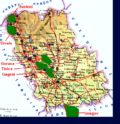
Prahova County has a large variety of relief shapes, being shared
in almost 3 equal parts: 1/3 of plane land in South, 1/3 of high
mountains in North, Bucegi and Ciucas mountains, and another 1/3
of hills. Much of the this terrain is covered by natural forests
from all kind of trees.
The
Prahova County has a large variety of relief shapes, being shared
in almost 3 equal parts: 1/3 of plane land in South, 1/3 of high
mountains in North, Bucegi and Ciucas mountains, and another 1/3
of hills. Much of the this terrain is covered by natural forests
from all kind of trees.
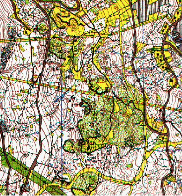
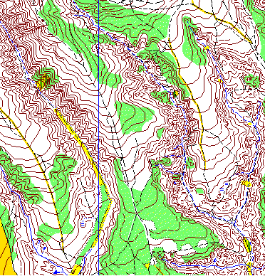
The members of this Club, have carthographed, drawn and printed a lot of orienteering maps from all areas in the county, as for example:
 Map Calea Codrului (oras Sinaia). |
 Map Poiana Goruna (Com. Cocorasti Misli) |
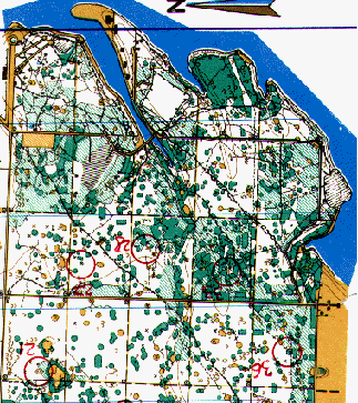 Map Snagov Parc (Com. Ciolpani) |
| Home | Calendar 2001 | Calendar 2002 | Clubs | About us | TVP 2002 | Addresses |
| nstroe@rdslink.ro |
![]()